Gravity & Magnetic Data Acquisition, Processing and Interpretation
Various kinds of geophysical data are available, sometimes summarised as Multi-Physics data. Usually, they are separated into Seismic and Non-Seismic. Seismic is, without any doubt, the dominant method used in the energy industry. But Non-Seismic data (gravity, magnetics, electrical, electromagnetics, etc) is the main source of information in shallow subsurface applications (engineering, mapping pollution, archaeology). It is also used in the early reconnaissance of new basins and plays and in mapping prospects below salt/basalt (Magneto-Telluric). However, seismic has its limitations and therefore also non-seismic methods are used successfully as complementary tools in subsurface evaluation. In combination with seismic data, they can significantly reduce the uncertainty of subsurface models as they measure different physical properties of the subsurface.
The course is partly based on an EAGE publication (Advances in Gravity and Magnetic Processing and Interpretation by J. Derek Fairhead, ISBN 978-94-6282-175-0).
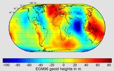
In the first part, various aspects of gravity will be discussed, such as the Earth gravity field, determining anomalies in the global field, establishing the depth of density anomalies, be it spherical or anticlinal and the resolution, which is limited because gravity is a “potential field”. Most promising is the development of gravity gradiometer, whereby gradients in the gravity field can be directly measured with great accuracy. These measurements are less sensitive to airplane and ship movement.
In the second part, the Earth’s magnetic field, also a “potential field” will be studied. Being mainly due to the internal dipole source, the inherently more difficult interpretation is simplified by applying a transformation to a monopole field (Reduction to the Pole or Equator). As different causative sources can produce the same surface measurements, non-uniqueness is allways present. However, promising developments to mitigate these issues will be shown.
Finally, we will discuss and apply the “latest and greatest” that is Machine Learning, a part of Artificial Intelligence, which is step-changing the geoscience world. We will use a standard package called Weka and familiarise ourselves with the “ultimate” open-source software Keras and TensorFlow. Exercises will be done using Weka and Google Colab. After the course, you should be able to try out Machine Learning on your own data. In addition we will experiment with ChatGPT.
The course
There are two types of courses, one virtual and the other F2F (classroom). In both courses Gravity and Magnetic applications will be discussed using lectures, videos and by doing many self-paced exercises. In addition, you will benefit from Moodle, facilitating interactions and discussions. In case of the virtual version, you can submit your questions in the discussion panel or your solutions of the exercises and receive feedback. To do the course you will have to install several open-software packages.
Learning methods and tools
The course uses a Blended Learning approach based on a user-friendly Learning Management System, called Moodle. In Moodle different modules provide study material, videos, and exercises. The solutions to these exercises can be checked and if the exercise is not clear or the solution cannot be found you can submit your “solution” and ask for feedback or in case of a F2F course discuss issues directly. Also, each part contains a quiz which is meant to reinforce the learning. The quiz consists of multiple-choice questions. For each question, all answers can be tried. The idea is that if the answer is not correct, one can go back to the course material to find out what the right answer should be or ask the instructor in case of a F2F course. So, don’t panic, it is not an exam.
Email: j.c.mondt@planet.nl
Website: www.breakawaylearning.nl