Skip to content
Home
About
Services
Contact
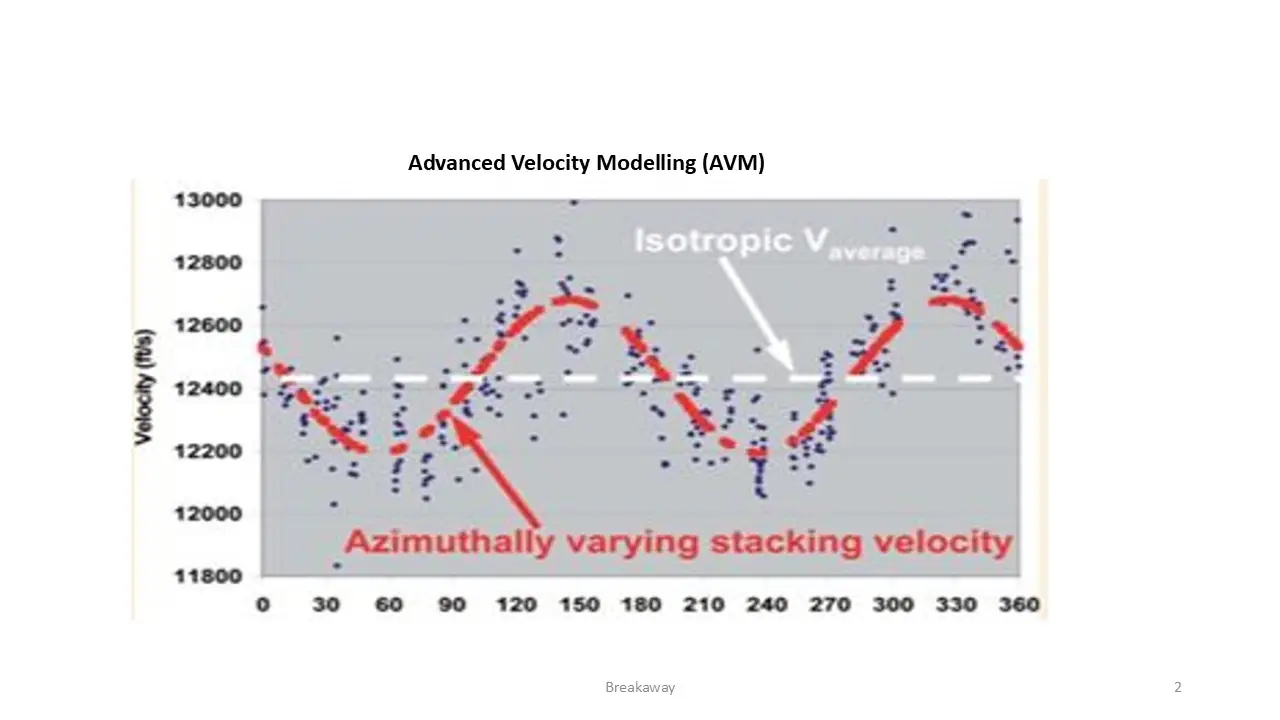
AVM
Contact
Services
About
Course News
Course News
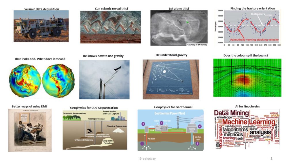
Geophysical curiosity
202-555-0188
202-555-0188
Main Menu
Home
About
Services
Contact
AVM
Contact
Services
About
Course News
Course News
Geophysical curiosity
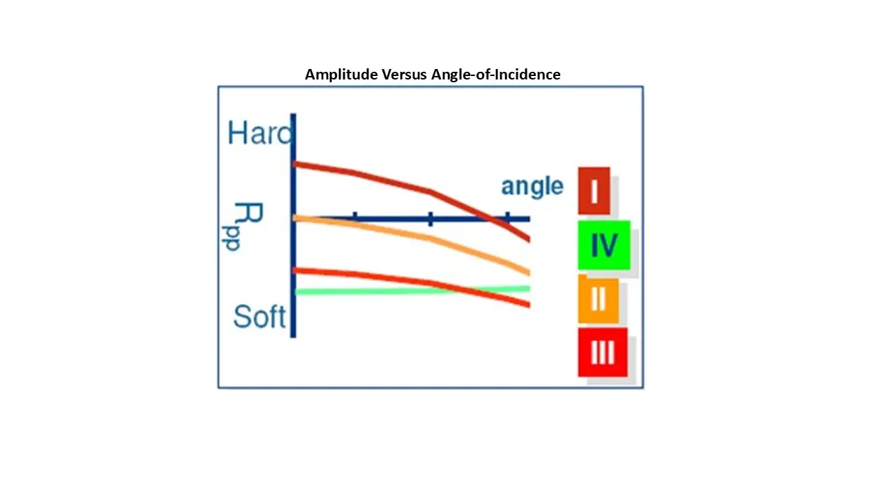
AVA + Inversion
Course Description
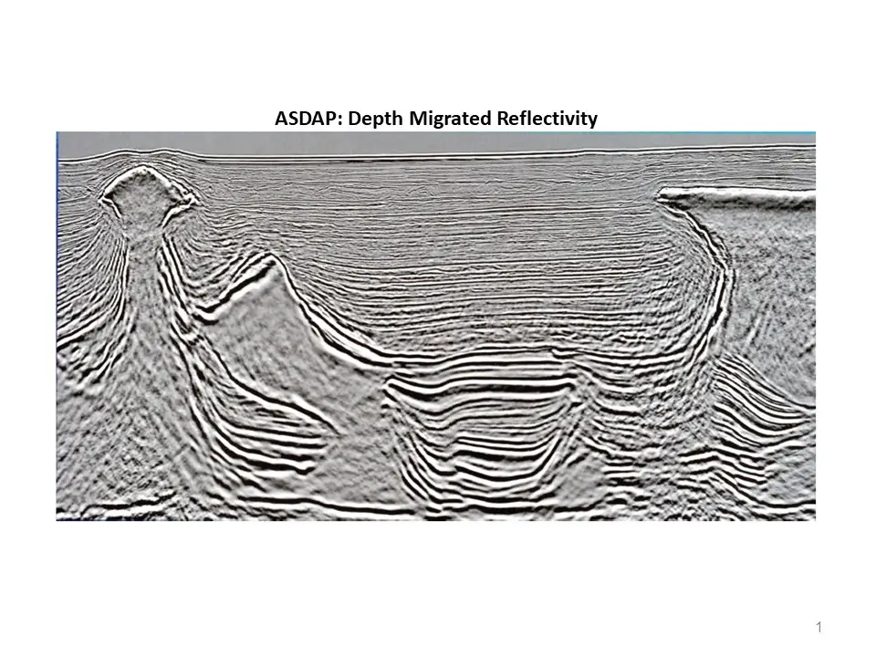
ASDAP
Course Description
AVM
Course Description
EM
Course Description
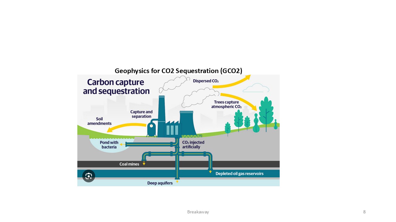
GCO2
Course Description
GDAP
Course Description
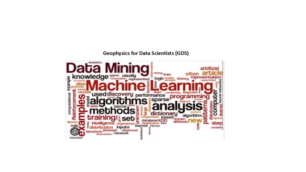
GDS
Course Description
GGE
Course Description
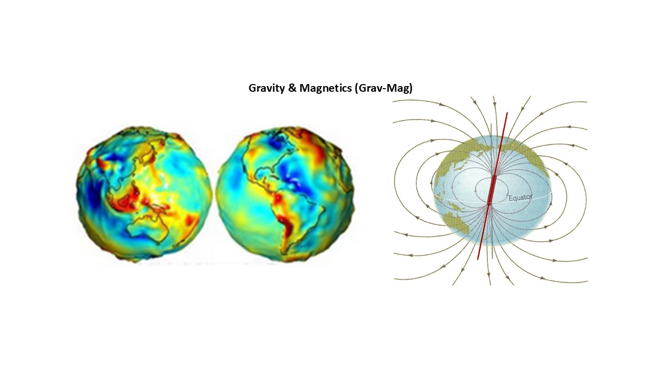
GravMag
Course Description
ML & DL
Course Description
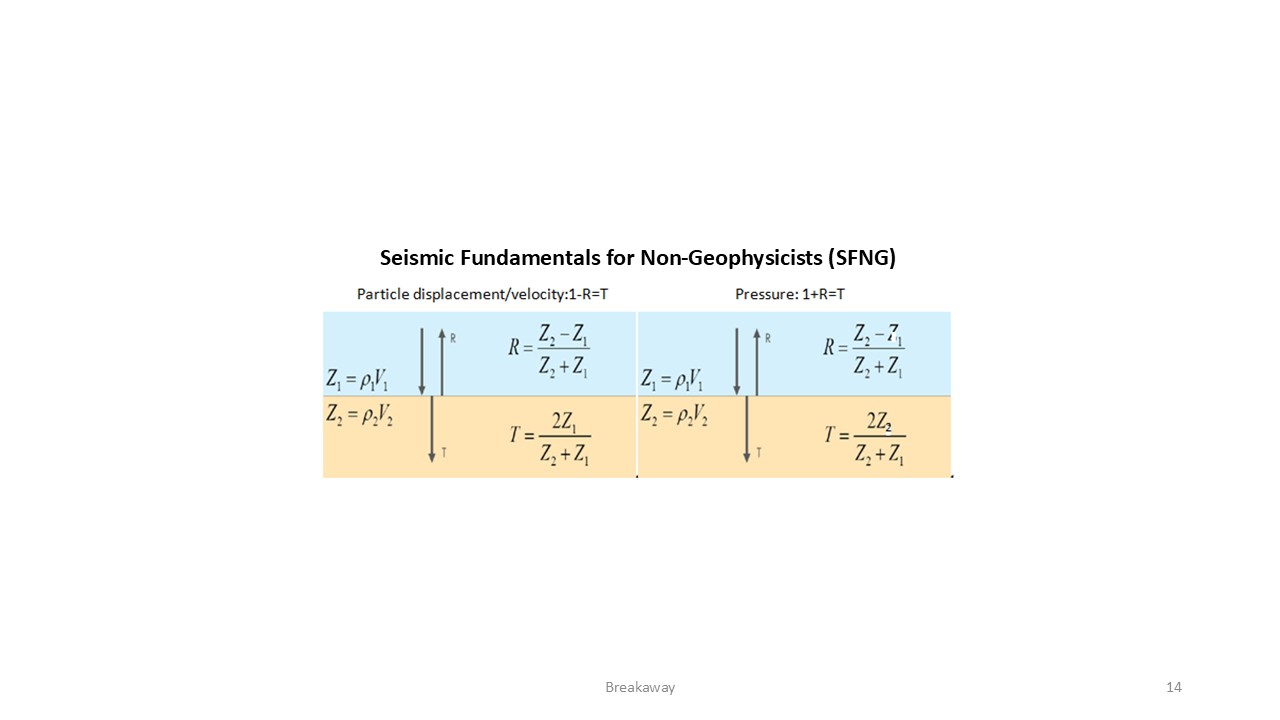
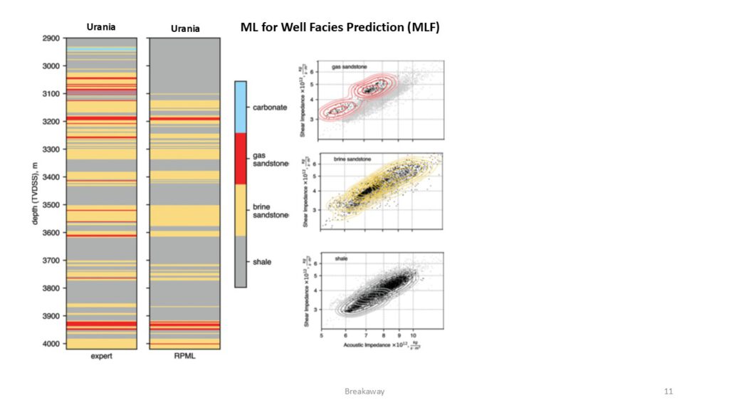
MLF
Course Description
MT
Course Description
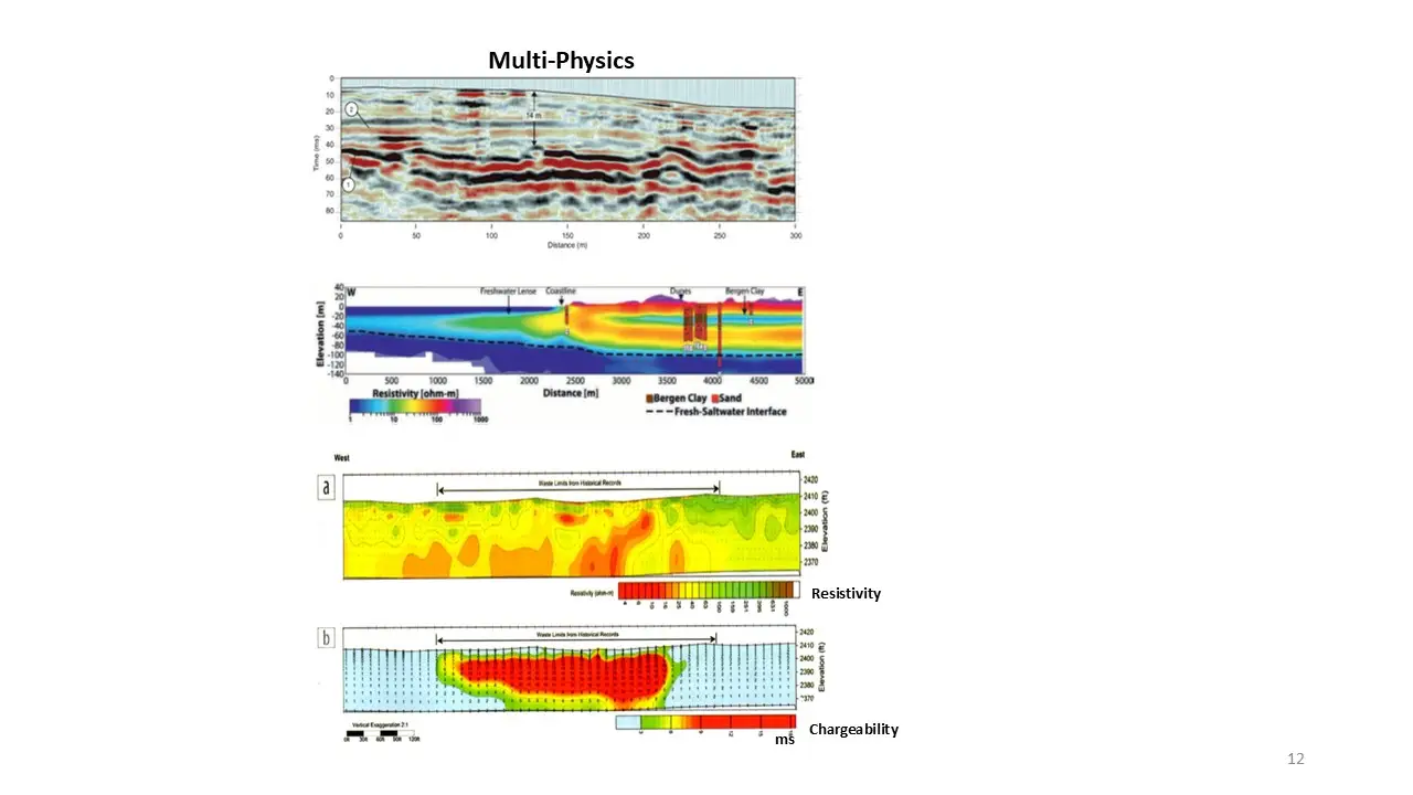
Multi-Physics
Course Description
Go to the course you have applied for
Geophysical Curiosity
Course News
Video of the month